From Hawaii to the Southwest – wow, what a contrast! We went from the lush rainforests of Hawaii to the dry canyons of Utah and Arizona in just a few days. Although the topography was world’s apart, it was just as beautiful in its own way. Our first stop in the beautiful southwest was Zion National Park in Utah. Now when you mention Zion National Park, most people think of two hikes: Angels Landing and The Narrows. As much as I wanted to try these two hikes out, there were a few things that stopped us. The main one was the time factor. To do these two hikes, people recommend starting out very early, like 7am. That wasn’t going to work for us because: 1) We were staying almost 2 hours away in Page, Arizona. 2) Due to the time difference (Arizona doesn’t observe DST, but Utah does), we lost another hour. 3) We had just returned from Hawaii, which means we were still dealing with jet lag from a 3 hour time difference. Although we didn’t do the 2 most famous hikes in Zion, we were able to do 3 and a half short hikes/walks in an afternoon plus a canyon drive which gave us an overview of the beauty that Zion has to offer.
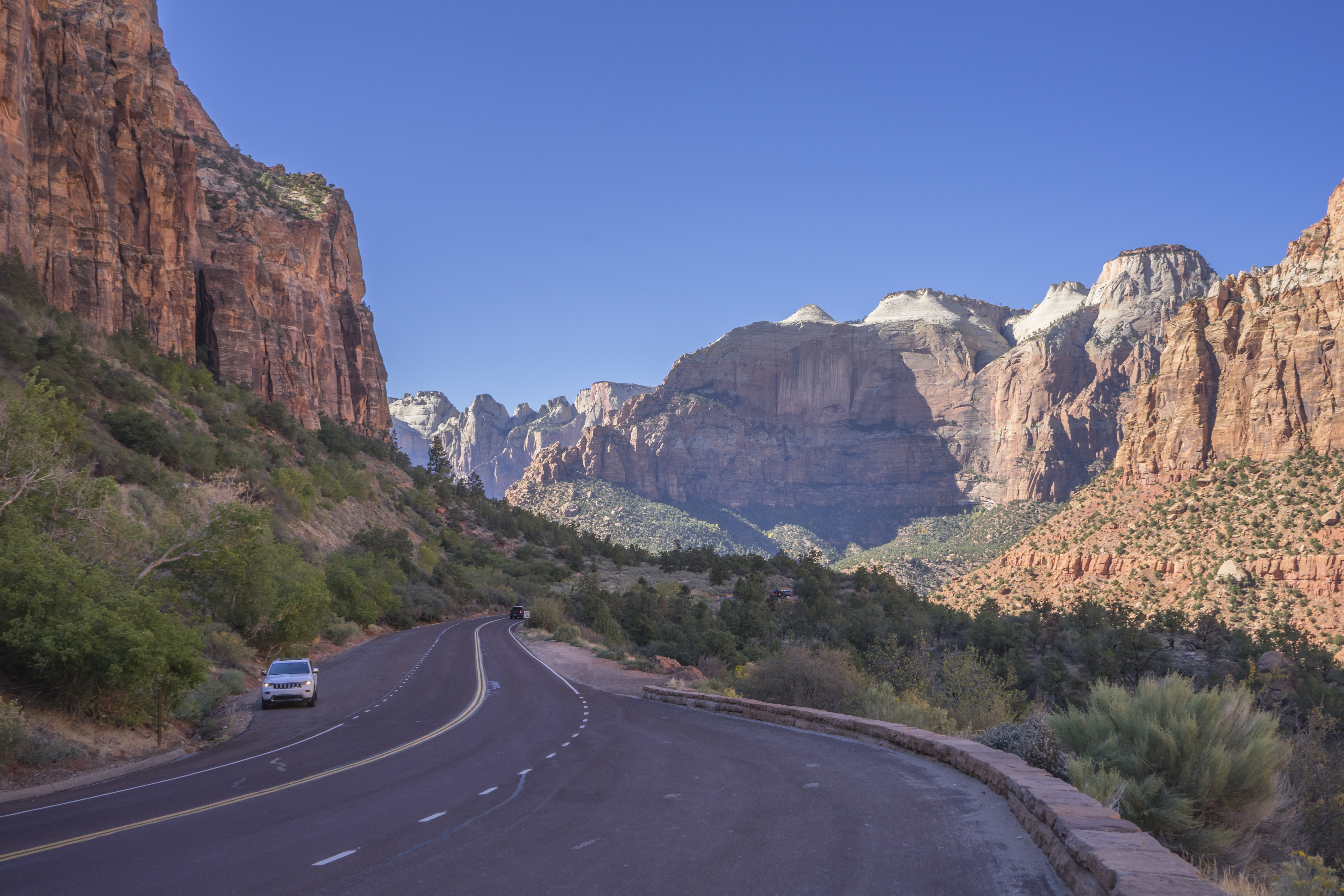
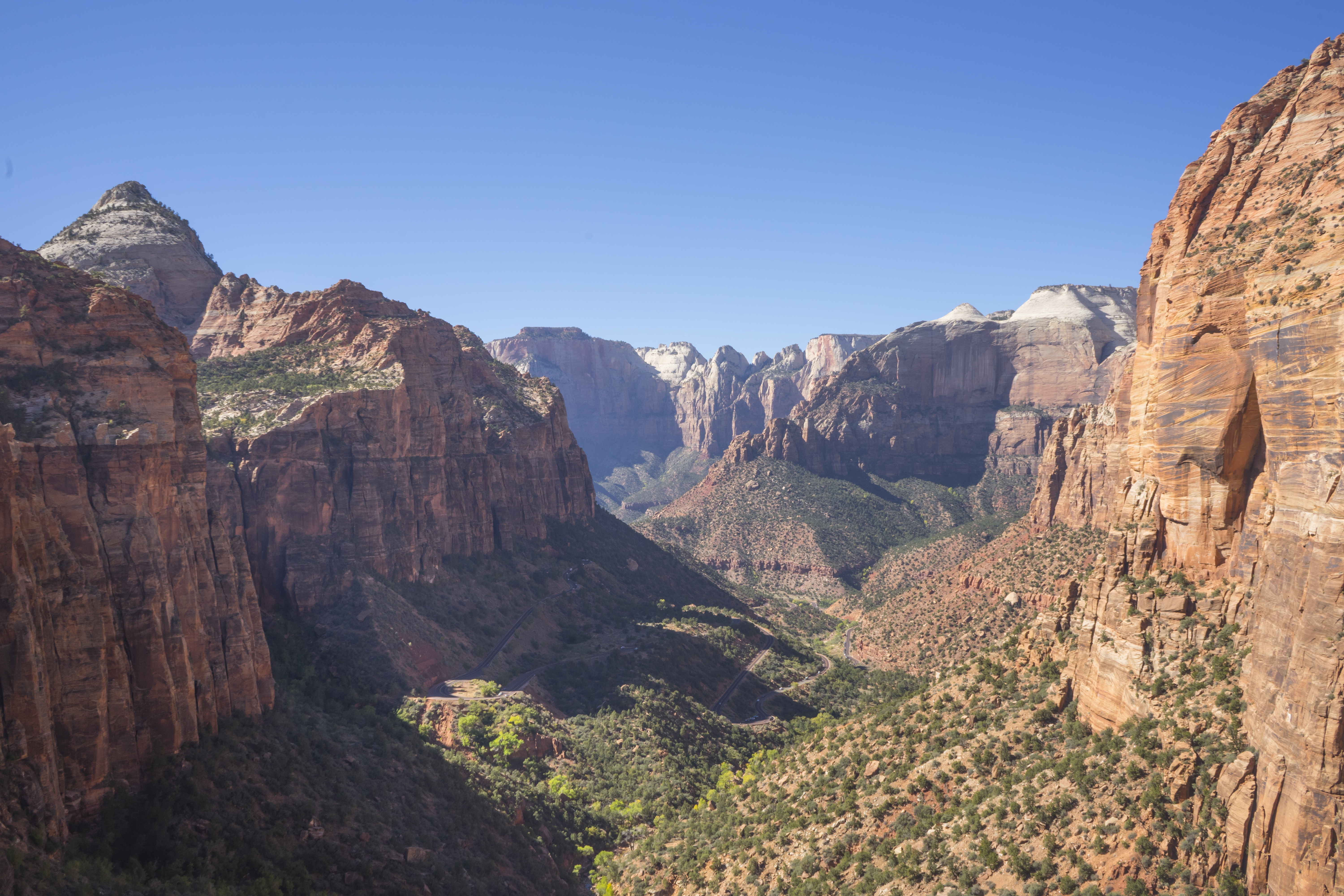
Zion – Mount Carmel Highway
Since we were coming from Page, our GPS led us to the east entrance of the park. (Note: Our GPS led us to the entrance of the park, but after that, we lost signal. Thankfully, there aren’t too many places to get lost in the park, but it may be a good idea to have an offline map just in case.) I’ve heard that the southern entrance can get extremely crowded, but we had barely any traffic coming from the east. The worse it got was when it was stopped up for a bit at the Zion – Mount Carmel tunnel. (This long tunnel is very narrow, so if an RV or another large vehicle passes, traffic in the other direction stops to allow the vehicle through.) Taking this highway also allowed us to access these beautiful views.
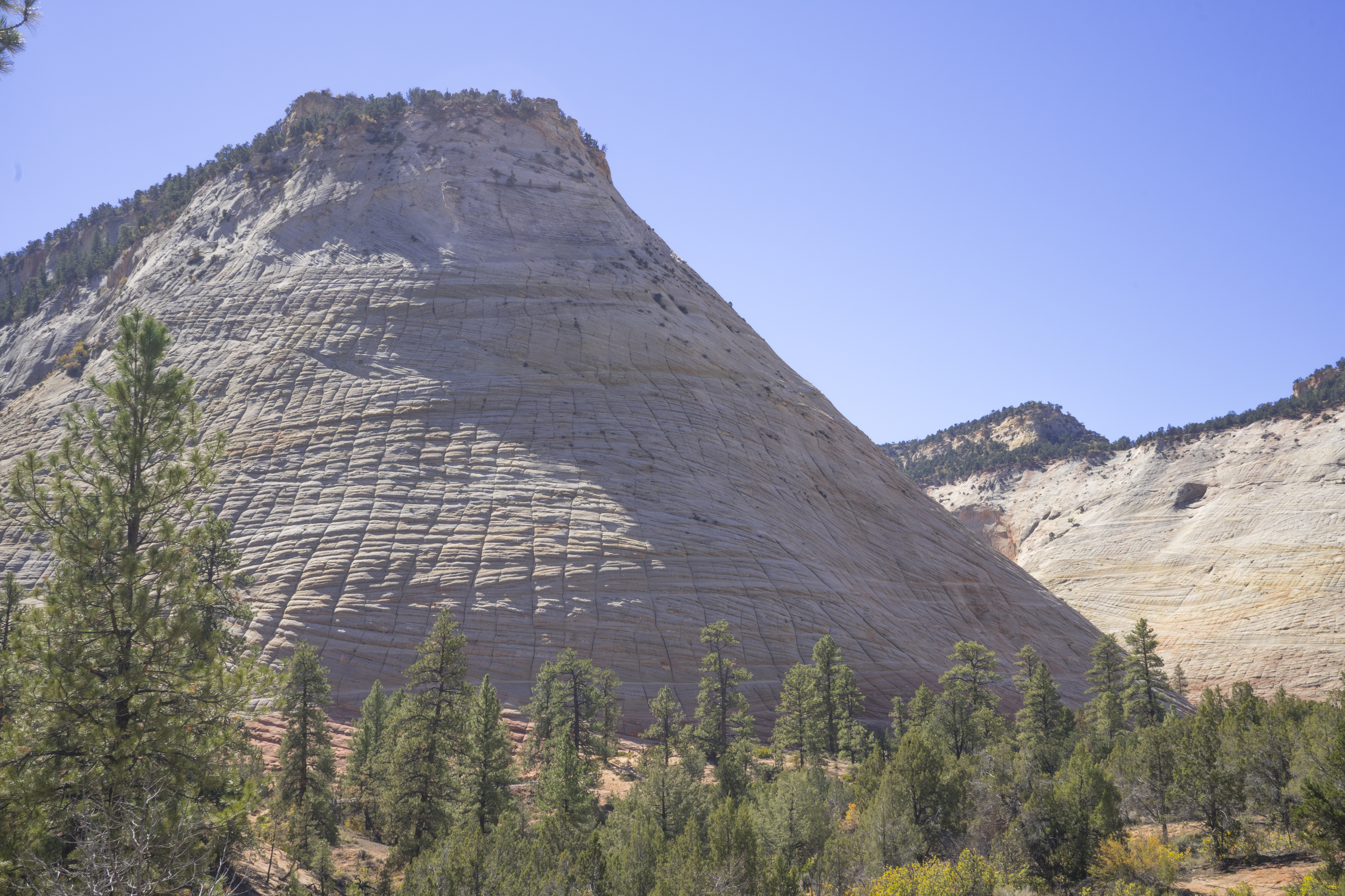
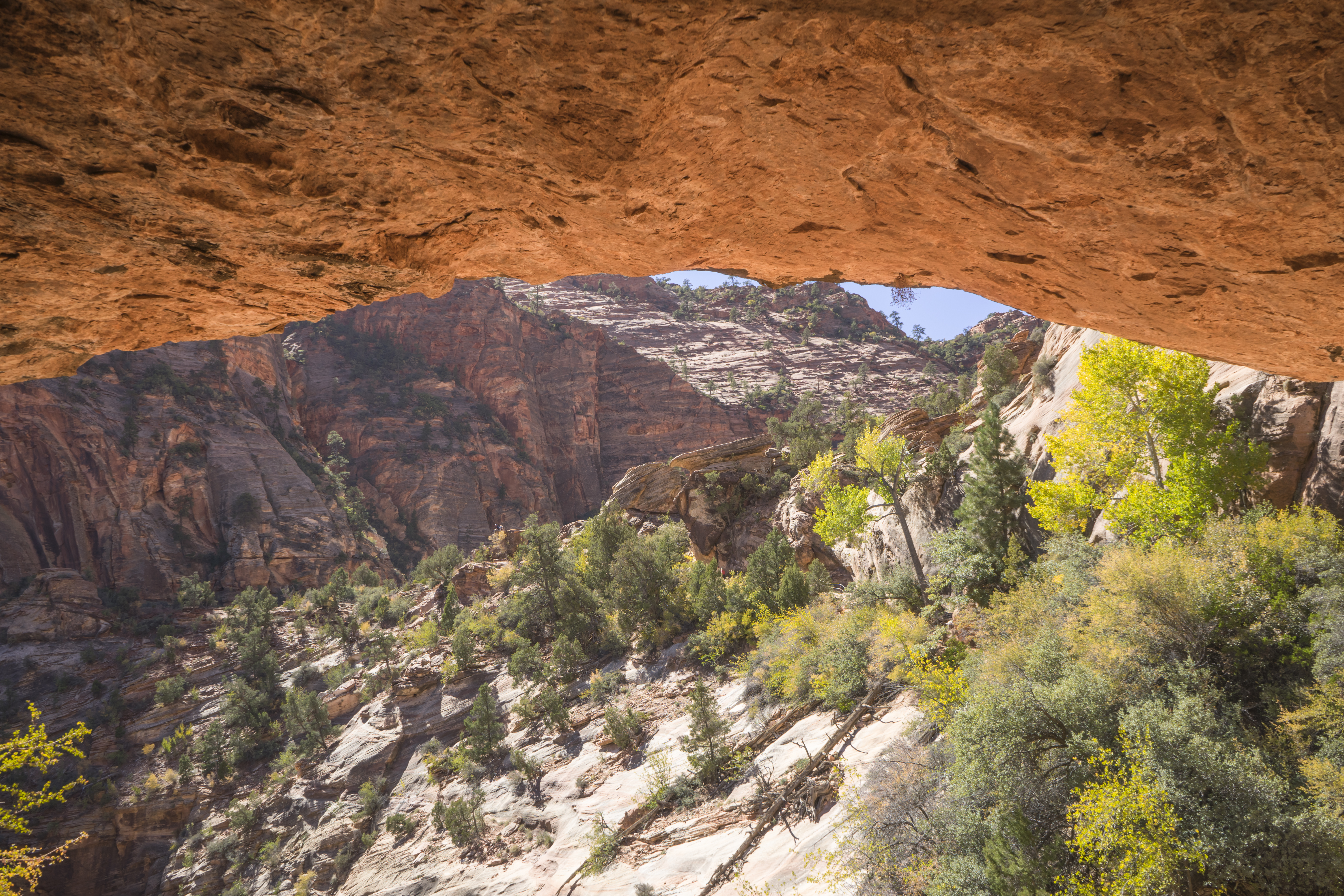
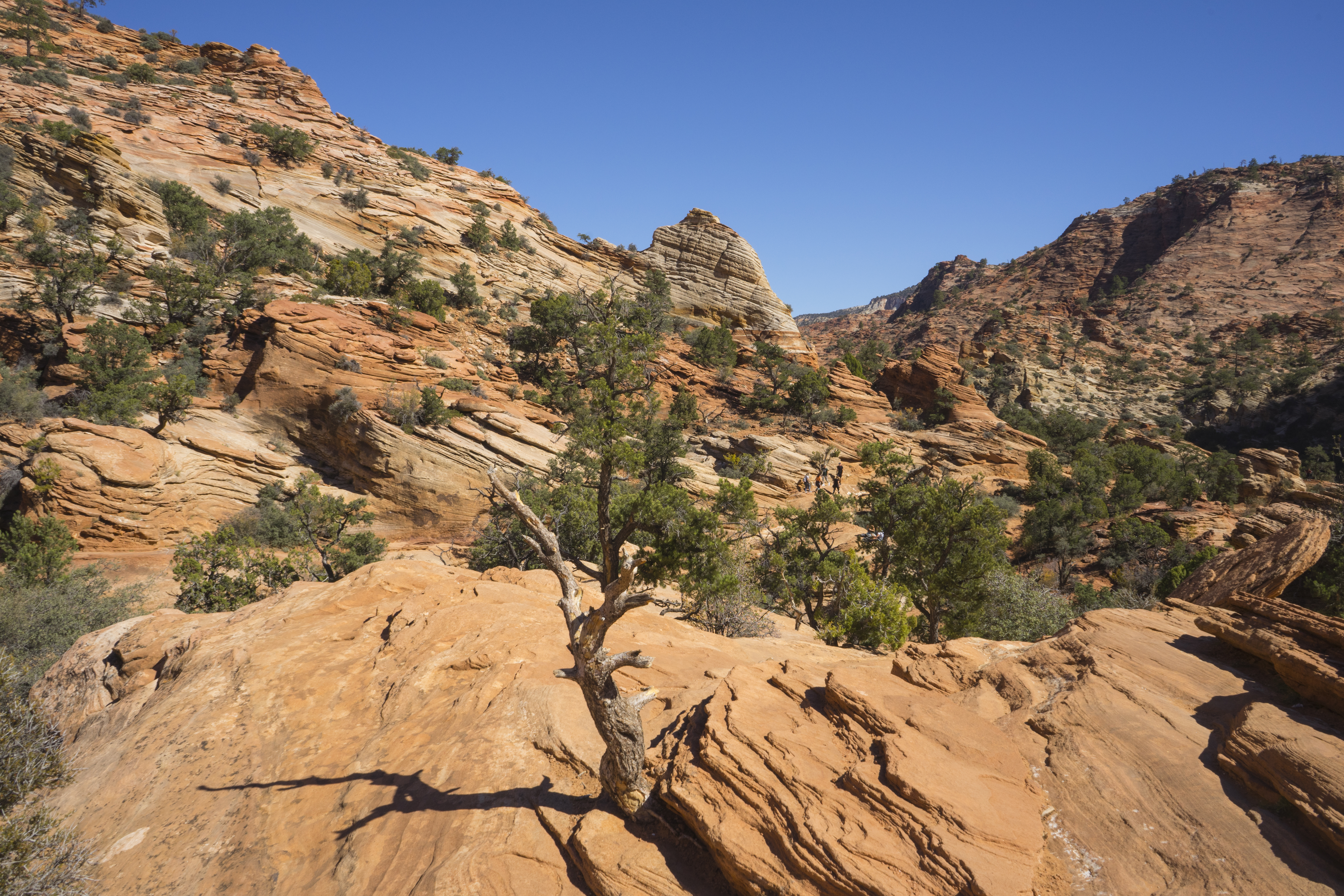
Hike #1: Canyon Overlook Trail (1 mi / 1.6 km)
The trailhead is located just before the entrance to the Zion – Mount Carmel Tunnel (if you’re coming from the east). Due to the traffic and all the cars parked on the side of the road, we were worried that parking was going to be a big problem. But when we finally inched our way to the small parking lot, we were able to grab the parking space of someone who was leaving. As we were leaving, we also saw other parking spaces available. Since this hike is relatively short, there’s always people coming and going so parking shouldn’t be too difficult to find if coming from the east entrance. (Of course, that can also be day and time-of-year dependent.)
This hike should take about an hour according to official guides, but it took us longer, likely because we were stopping and taking photos every few minutes. Also, there were narrow areas and staircases, and due to COVID, we preferred to stop and wait for hikers coming from the opposite direction to pass. Overall, this was our favorite hike of the day – the lighting was great and the views were outstanding!
After this excellent start to Zion National Park, we headed further down into the canyon. The other main sights we wanted to see are not accessible by car most of the year. Due to the abundance of traffic, Zion Canyon Scenic drive is only accessible to bikes and shuttles. So our next stop was to the Zion Canyon Visitor Center, where we could board the shuttle. Here’s the only problem with parking at the Visitor Center – there isn’t much parking there. At all. In fact, the recommendation if coming from the south is to park in the town of Springdale (for a fee) and take the shuttle into the park. But we weren’t going to exit the park to the south just to take the shuttle back in unless we were really desperate. So we circled in the parking lot a few times and after about 5 minutes (and continuously asking people at their cars if they were leaving only to be shot down), we finally found a couple who was leaving. 🎉
After parking, we quickly boarded a shuttle. Here’s another advantage of coming a little later. Sometimes the lines for the shuttle can be really long, and we often saw long lines, but these were always for shuttles going in the opposite direction. We never had any problems boarding shuttles and they were pretty empty, too.
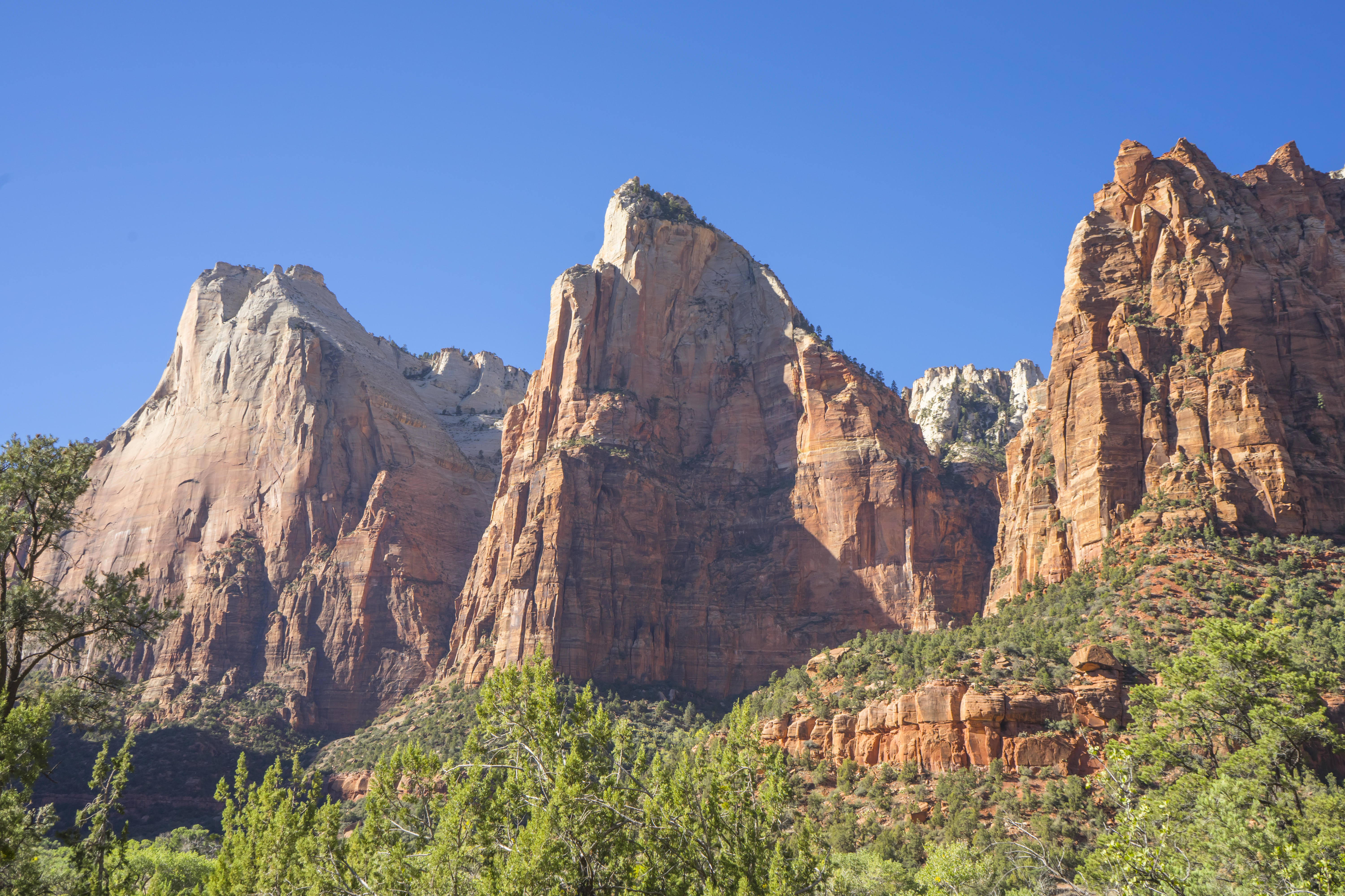
Hike #1.5: Court of the Patriarchs (0.18 mi / 300 m)
Ok, so this was barely a hike. But there was quite a steep incline, so we must have burned some calories on it, right? Due to the brevity of the hike, we were able to jump off the shuttle, hike up, take a few photos, and hike back down in time for the next shuttle. And for not a lot of effort, we were rewarded with this beautiful view.
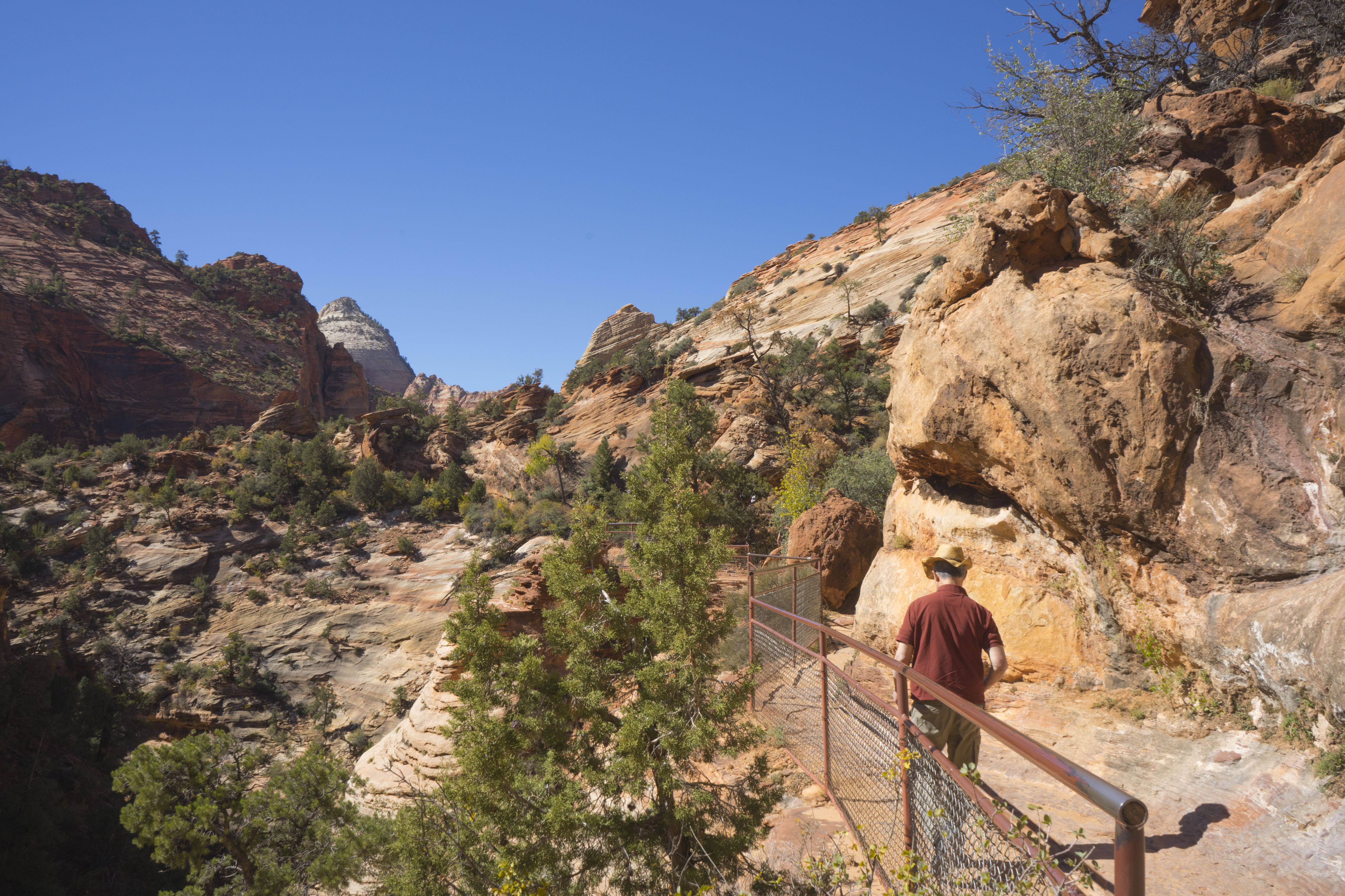
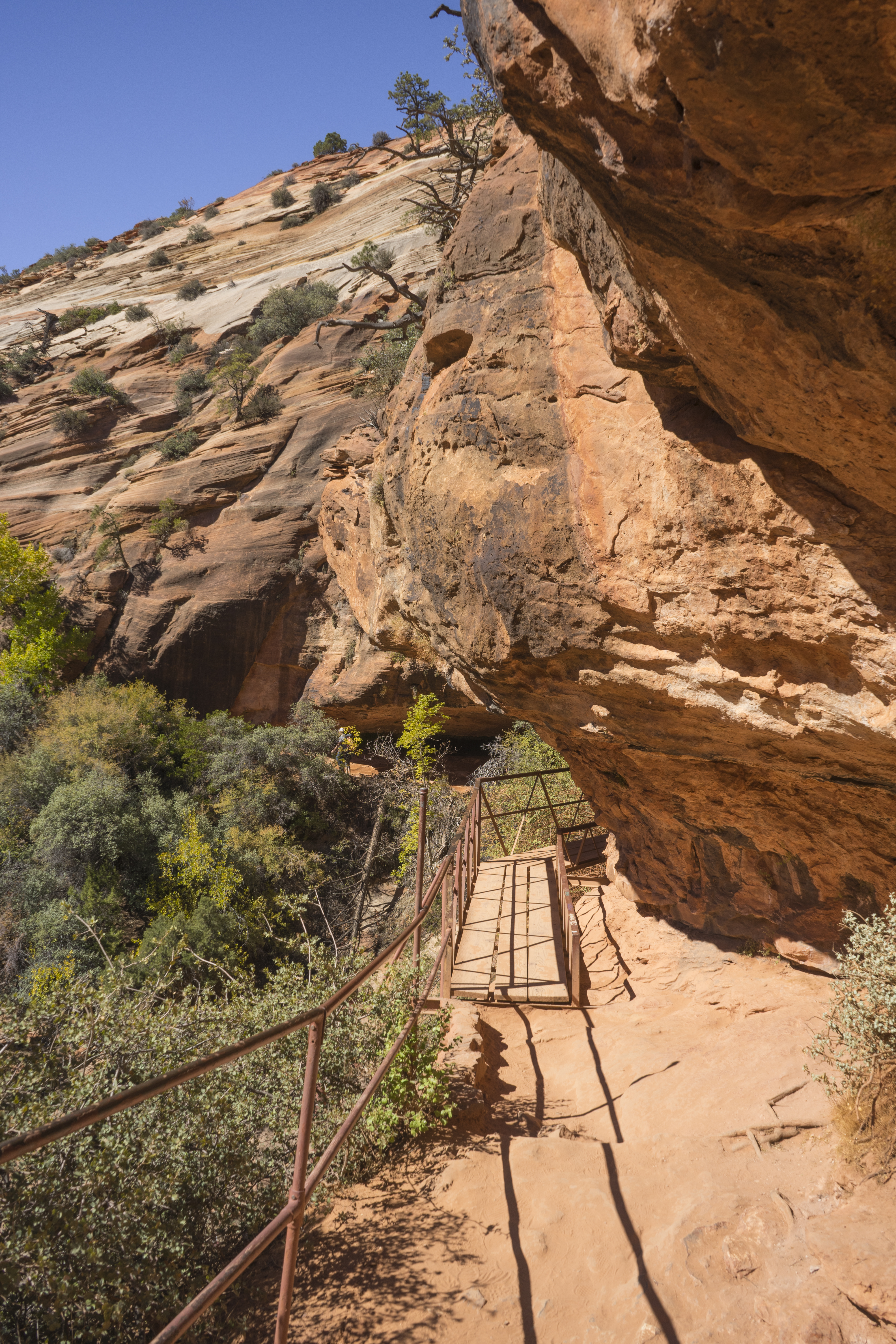
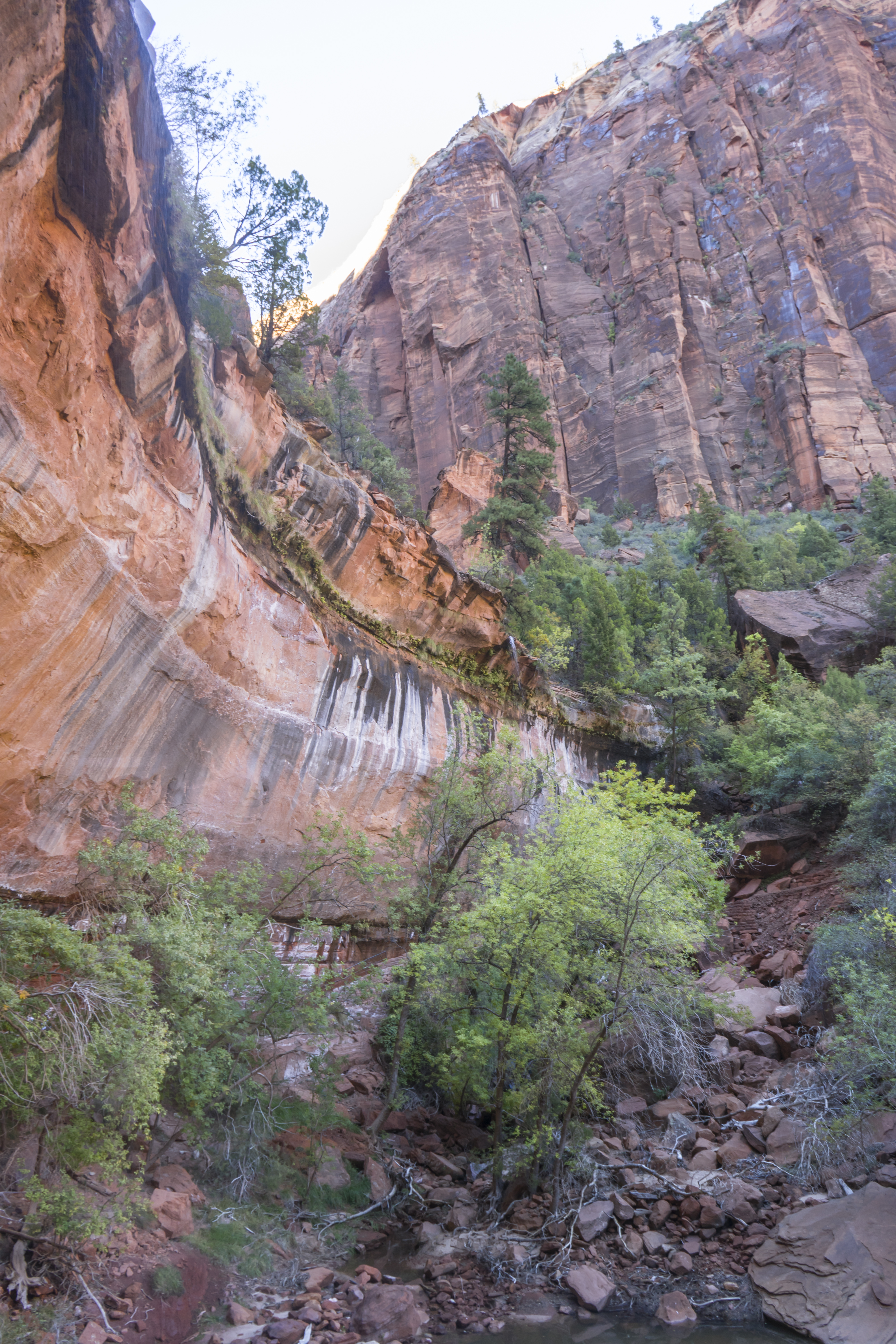
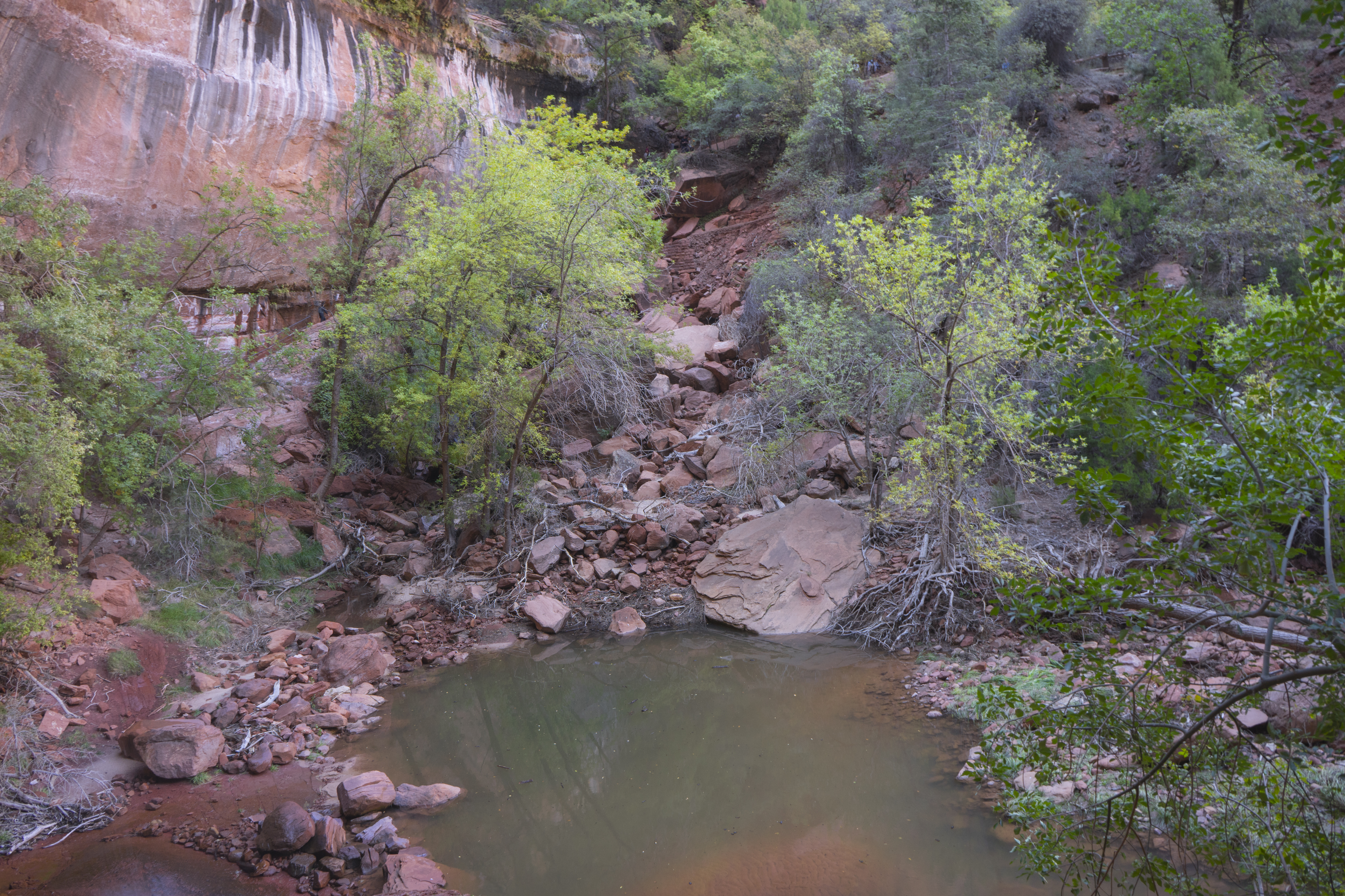
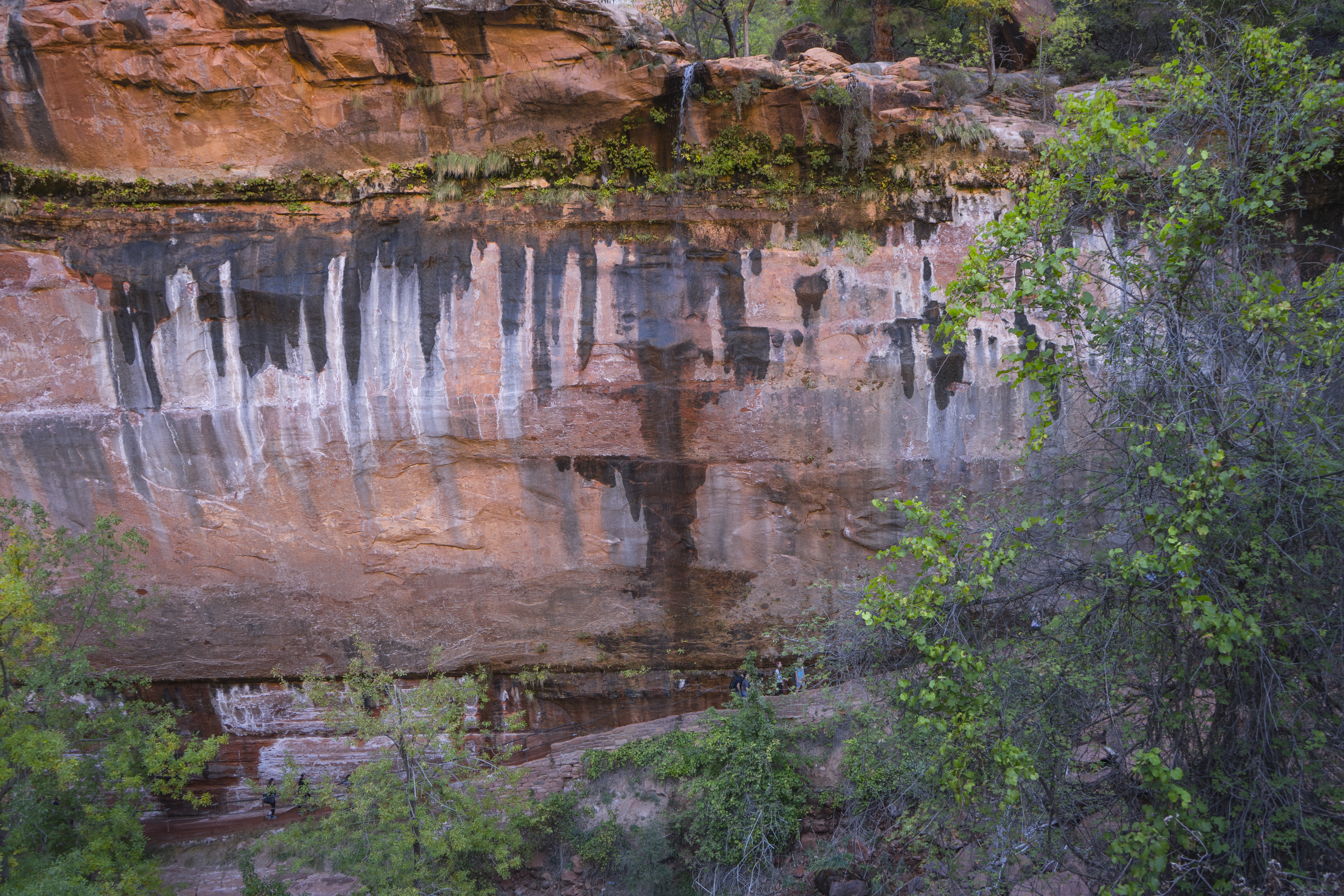
Hike #2: Lower Emerald Pool (1.2 mi / 1.9 km)
The trailhead for Lower Emerald Pool is right across the way from the Zion Lodge, which was great for us to be able to grab a bite to eat (the black bean burger was pretty good!) and refill our water bottles. There are 3 Emerald Pool trails (Lower, Middle and Upper), each adding about 1-1.5 hour to the hike. Since we were running out of daylight, we stuck to the Lower Emerald Pool trail, which was about an hour long. There were definitely more people on this trail than on our previous hike, but the trail was wider which made it a little more comfortable, COVID-wise.
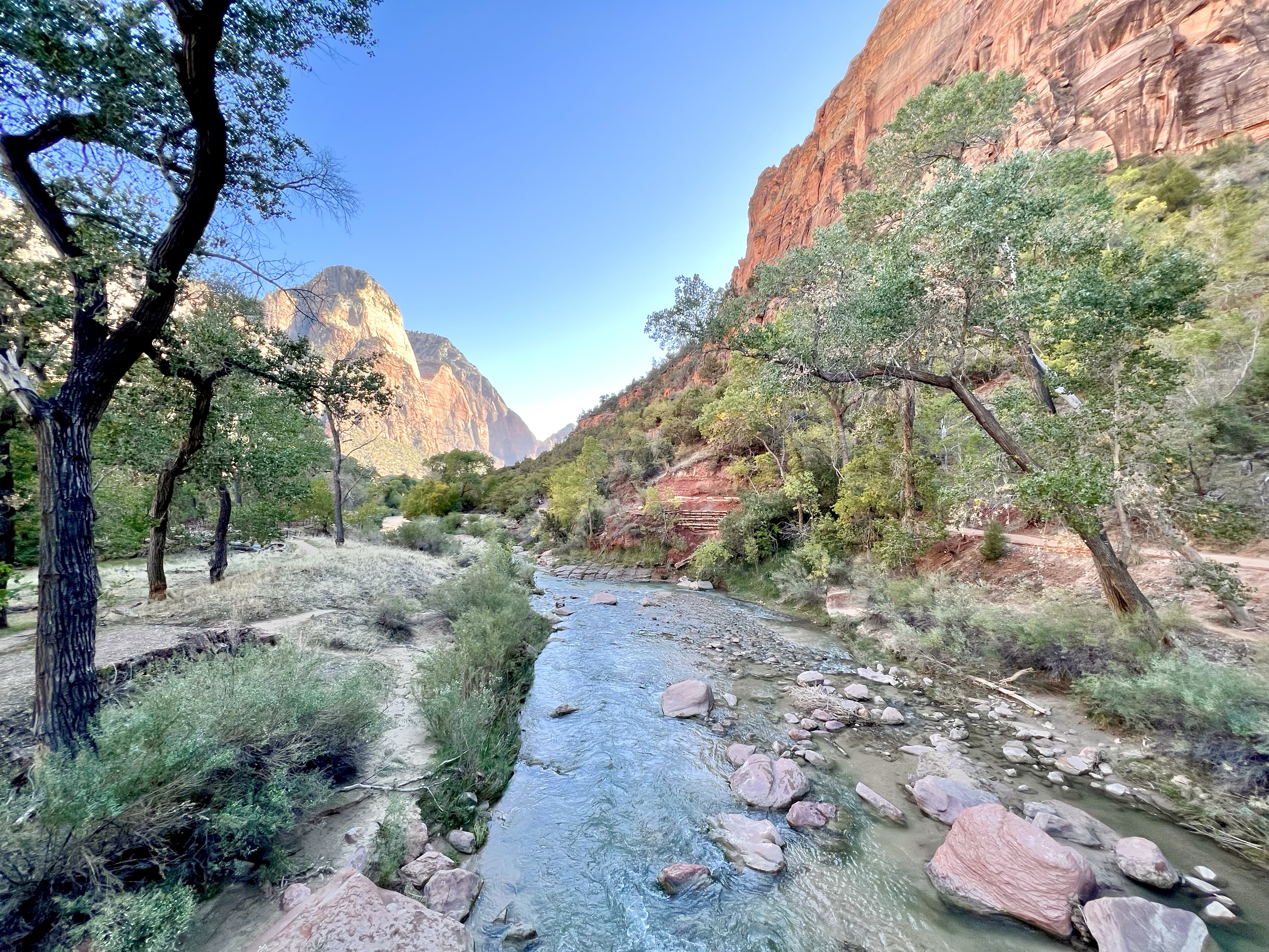

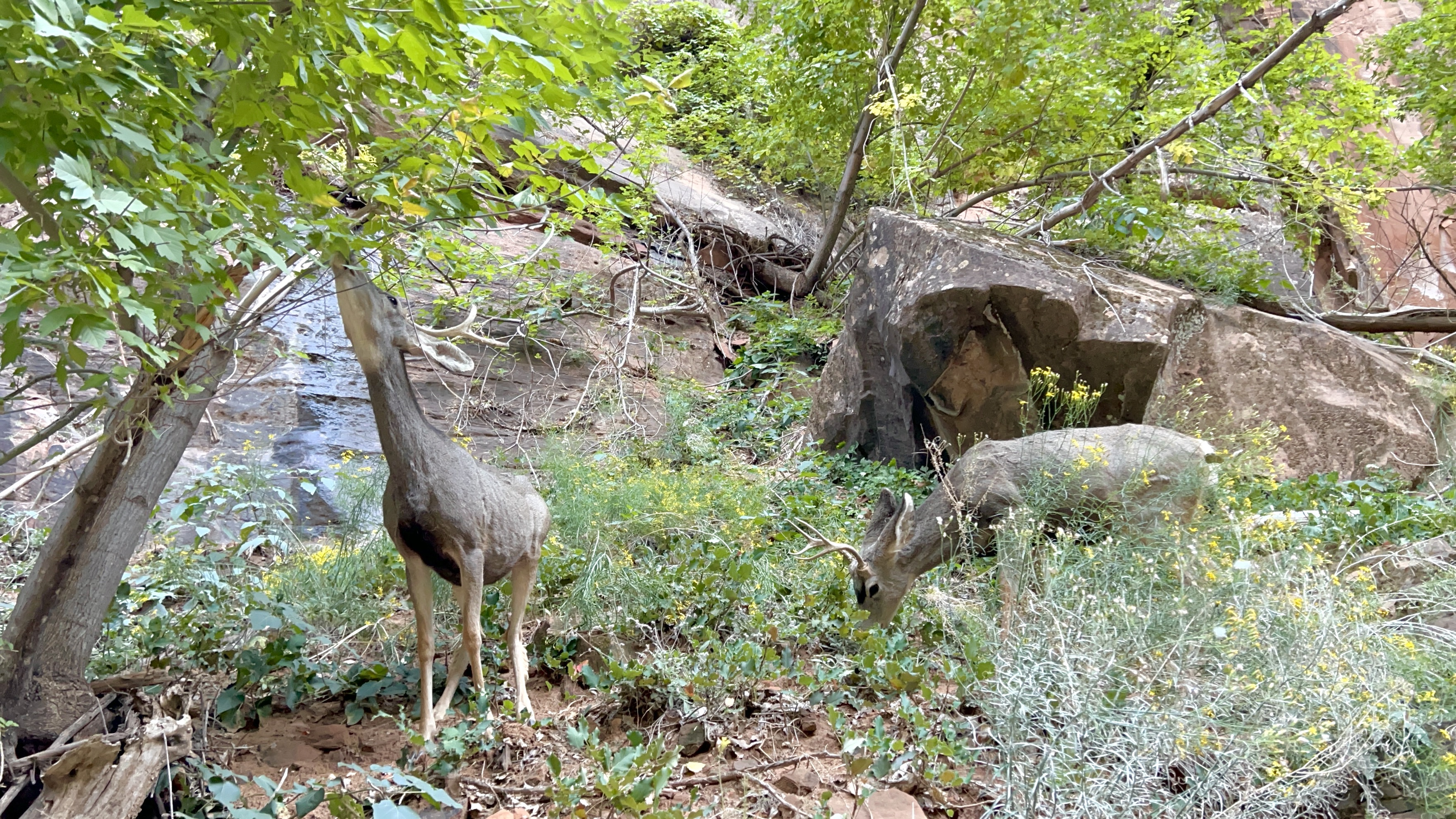
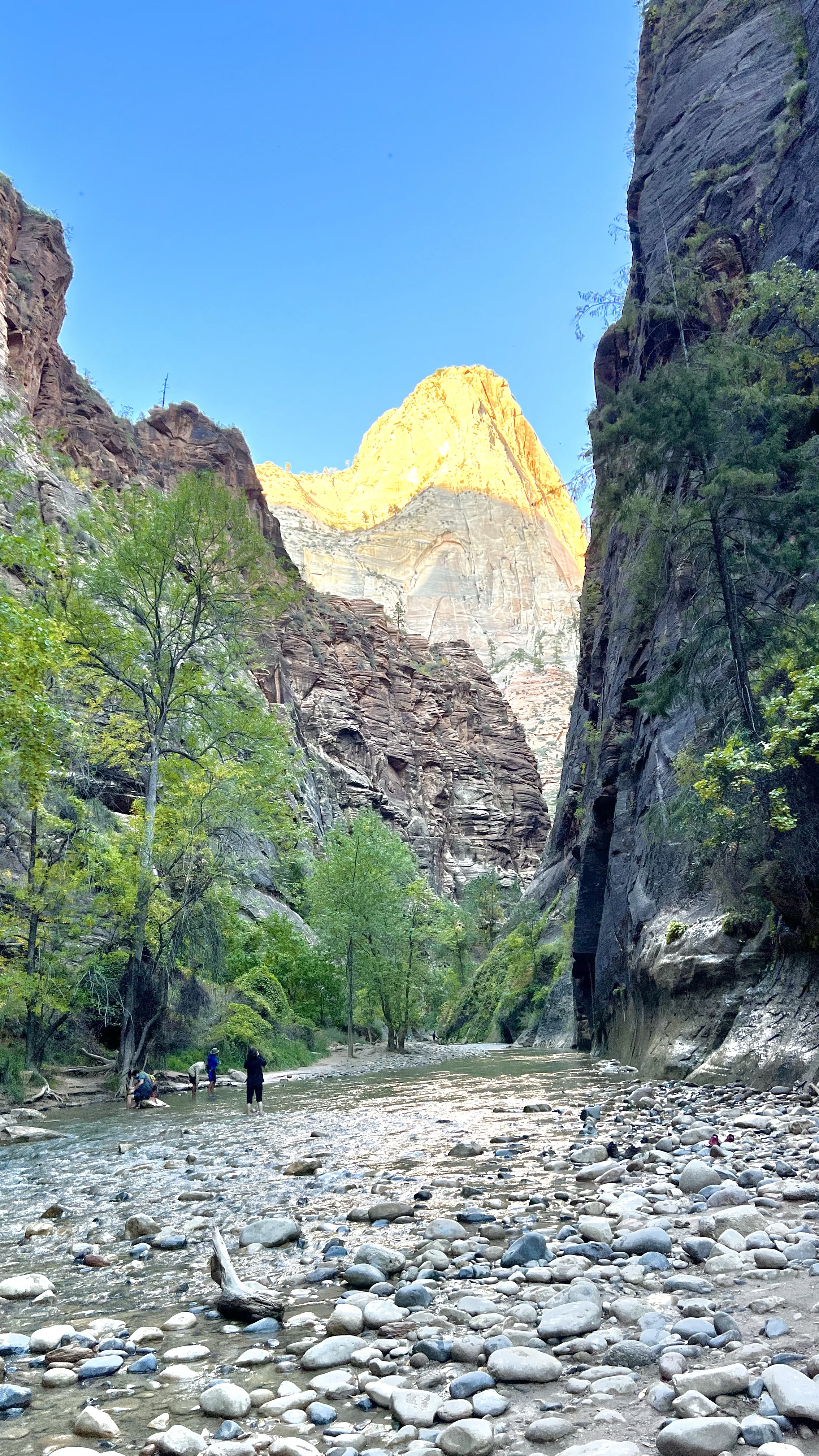
Hike (or more like a Walk) #3: Riverside Walk (2.2 mi / 3.5 km)
Although we only had an hour of daylight left, I was determined to fit this last walk in. Riverside Walk is actually the beginning of the popular hike called The Narrows. It takes about 1 and a half hours round trip, whereas The Narrows can take up to 8 hours and requires special waterproof shoes and pants (a lot of wading through water is involved). The advantage of doing this walk so late in the day was that, once again, there were few people on this popular trail and most of them were returning from doing The Narrows, which meant that on our way back, we had the trail to ourselves.
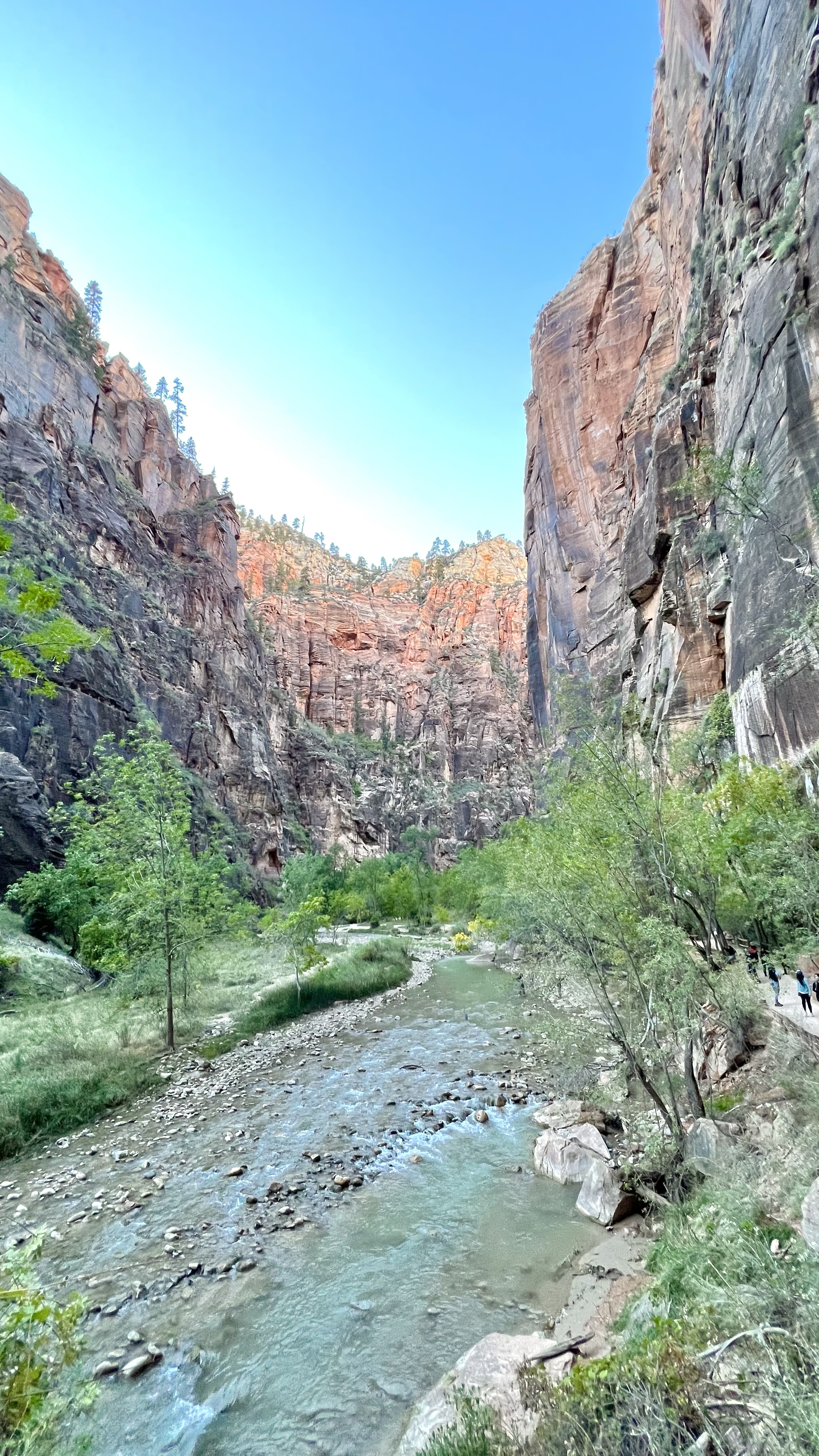
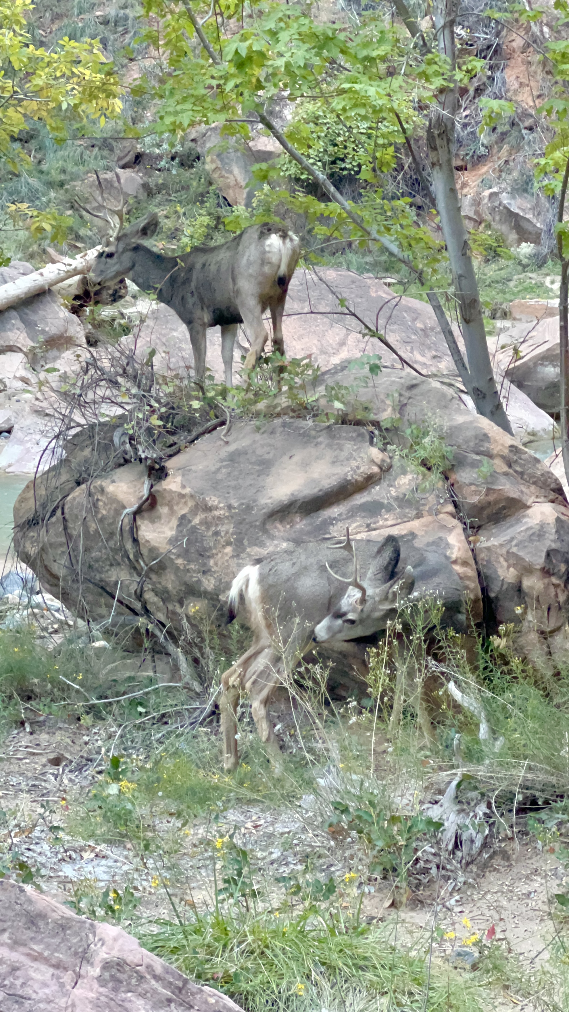
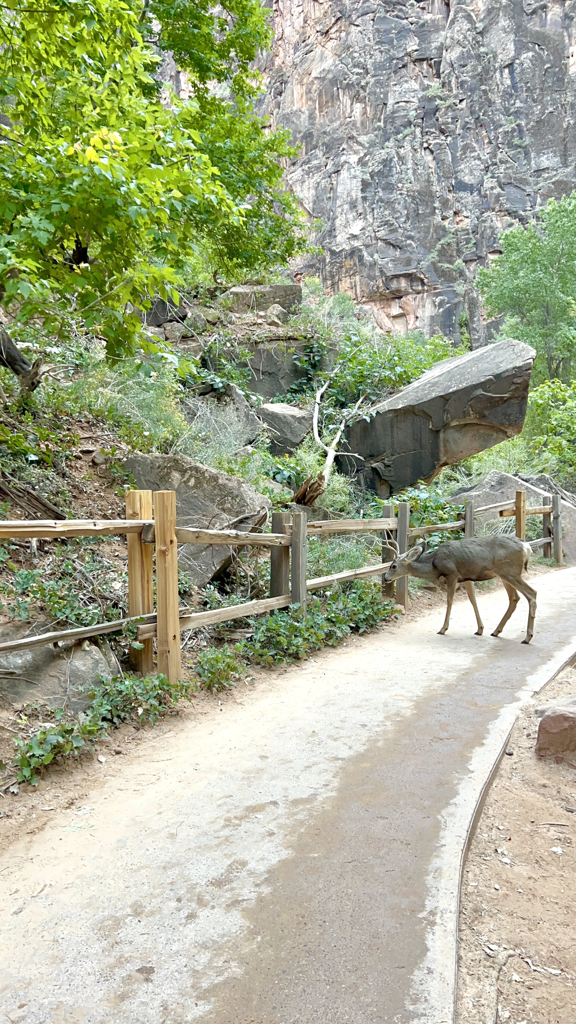
I was so happy that we decided to squeeze this last walk in, because it was completely different from the other trails that we had done earlier. As its name implies, this trail led us by the winding river. Because the river flows through this canyon, there were lots of trees and even some wildlife that we were able to observe.


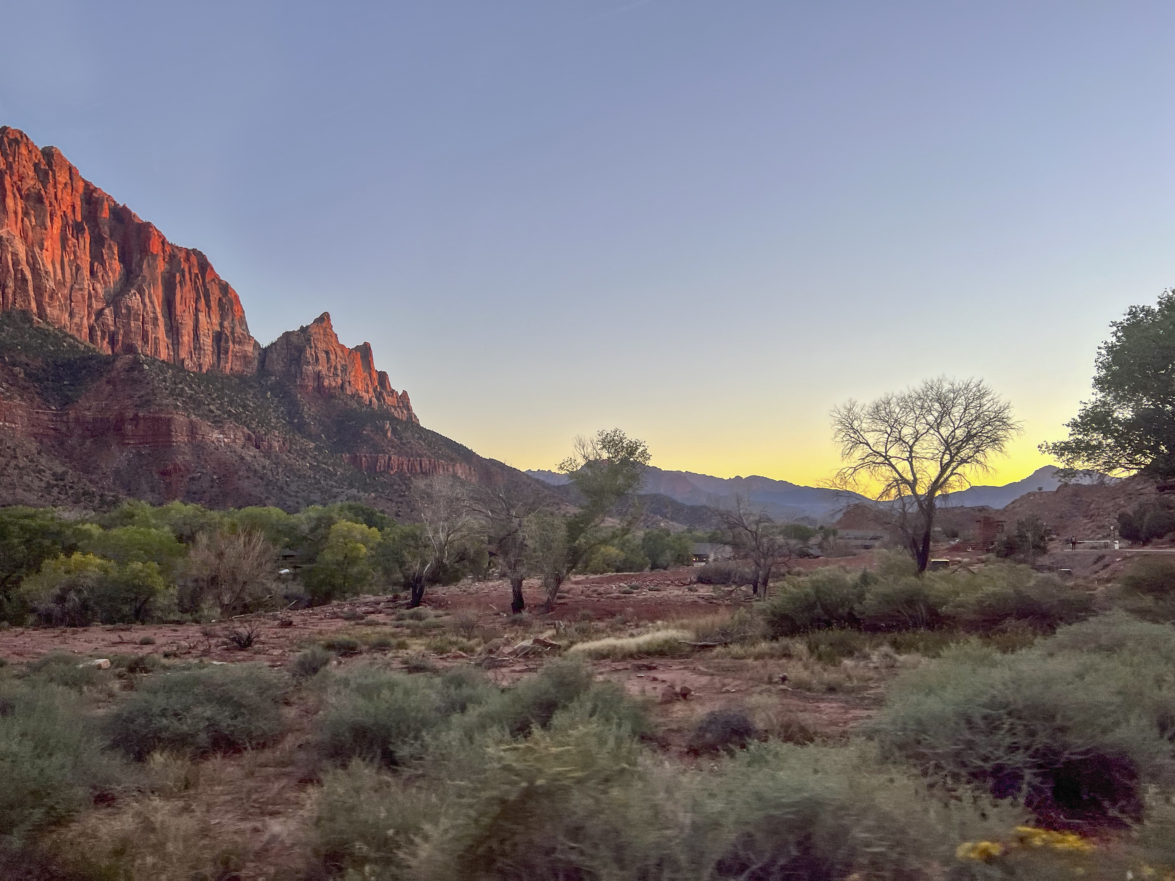
Thankfully we finished the 1.5 hour walk in an hour, which even allowed us time to stop and take photos. It helps that this trail is mostly paved and relatively flat, so we could walk faster when necessary. We caught one of the last shuttle buses (once again empty) and caught this beautiful sight on the ride back to the Visitors Center…
And that was our visit to Zion National Park in a nutshell. I would like to come back and do Angels Landing and The Narrows, but I would do it only if I could stay closer to the park. (Note: I’ve heard that starting April 2022, the National Park Service is going to require permits for Angels Landing, so keep that in mind.) For the amount of time we had, we were able to get a great overview of the park and see some beautiful sights.
The main reason we were in the area, though, was to see some of the natural (and manmade) wonders near the town of Page, Arizona. That’s coming up next!
Until next time,

Subscribe to stay in the loop:
And if you like my posts and would like to support further ones, feel free to buy me a croissant (or coffee) by clicking the link below. Thank you to those who have!